

You must log in or register to comment.
It’s also the only continent without a southern coast.
For now. It used to a few million years ago and will again in another few million.
Are you referring to the magnetic pole switch? That happens every 200-1M years, according to patterns on the seafloor. It’s been estimated that the last reversal was 780,000 years ago, so it theoretically could be any day now.
With that being said, I doubt that humanity will agree to turn all maps 180° to correspond.
I thought they were referring to the fact that under the ice its an archipelago, so if the ice melts it will have southern coasts again
If it melts, they’d all be northern coasts.
It’s referencing the pole swap.
Ok, but that’s unironically a great map for a TTRPG campaign.
I’m thinking Lovecraft. Plateau of Leng and all that. There’s just this huge, impassable land that goes south for what seems like forever. And…things…occasionally wander out of it.
Uh, antartica is about as wide as the U.S. and about as tall as it is wide.
So, I just feel like I’m being bamboozled here
Yeah, they certainly are:
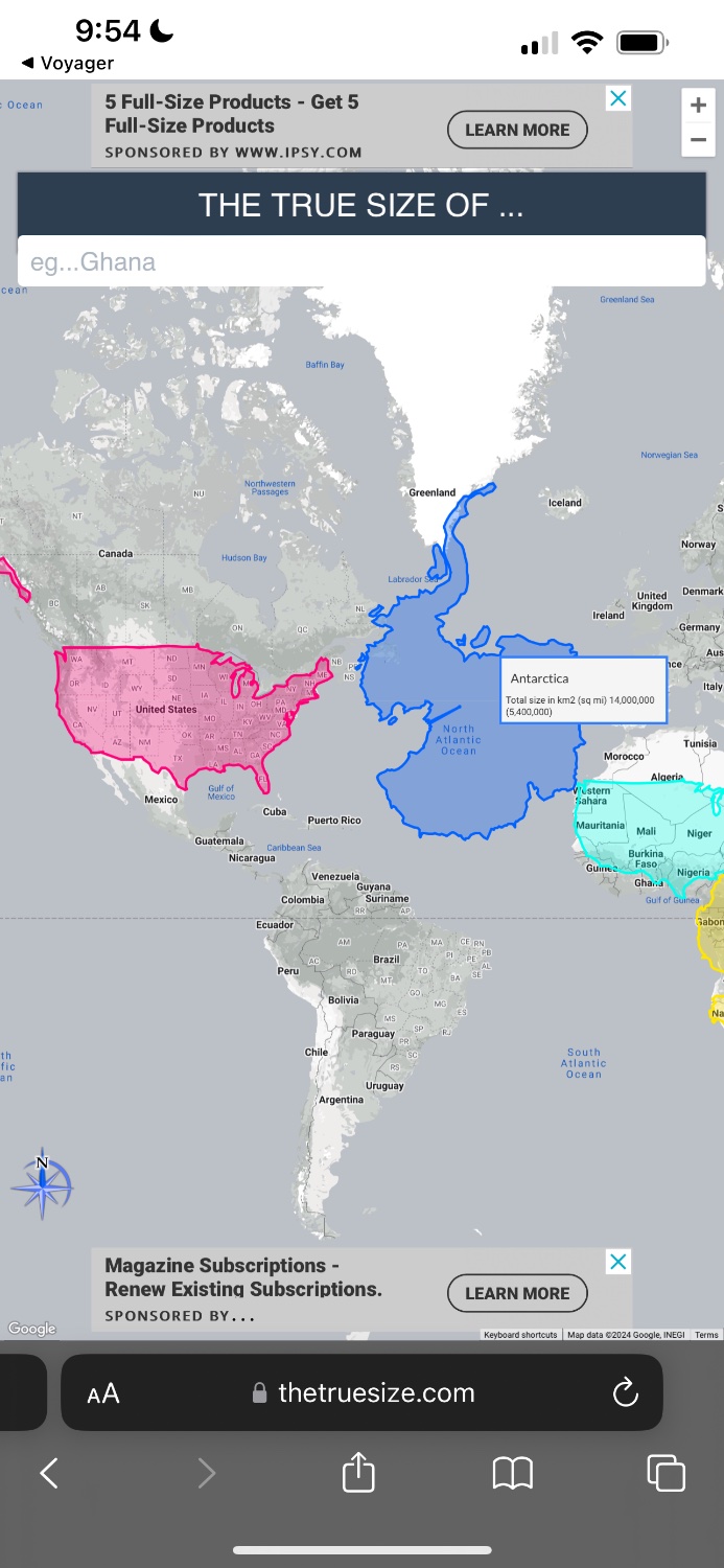
That is inaccurate. The correct way to use the tool is to lay the continent over the US. It skews the size and scale appropriately in order to provide an accurate measurement.
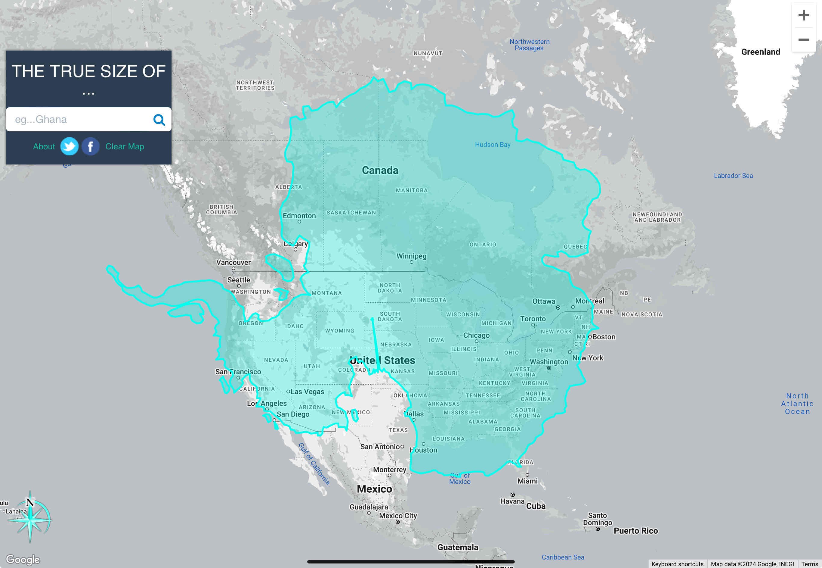
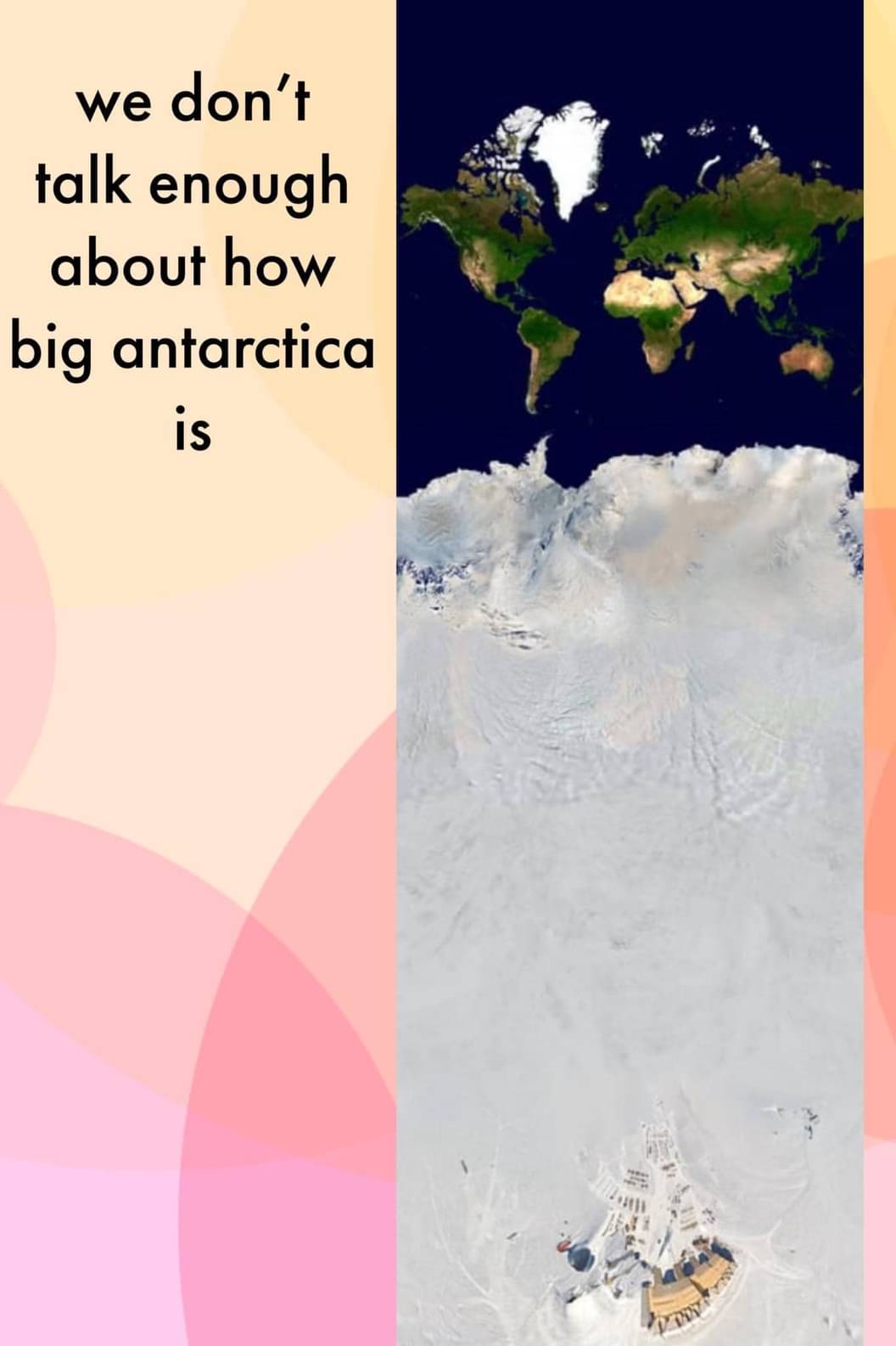
It’s also larger in area than the US, including Alaska and all territories.
The total area of the US and its territories is just over 3.8 million square miles. Antarctica’s area of 5.4 million square miles makes it 1.5x the size of the US.
