
3·
1 day agoThanks so much for posting such a detailed reply. I appreciate it and will be looking into this in the near future.
Thanks so much for posting such a detailed reply. I appreciate it and will be looking into this in the near future.
What’s the most interesting thing you could tell us about CPU design, something that a layman could appreciate.
You should know as a software developer I write inefficient code and appreciate all the extra clock cycles we get these days haha.
What’s the logistics of this? I work remote 3 days as a software dev and I’m hoping to eventually get full WFH.
How does one just move to another country to work from there. Do you need a lot of cash on hand to make the move or can you just be a nomad kind and do it.

It’s not amazing but the main character has such charisma that you can take the ever more extravagant plot lines.
Probably not, gorilla pretty tough.
I’ll tell her when we finish up here.
You guys are coming at this from the right angle.
As a rule of thumb.
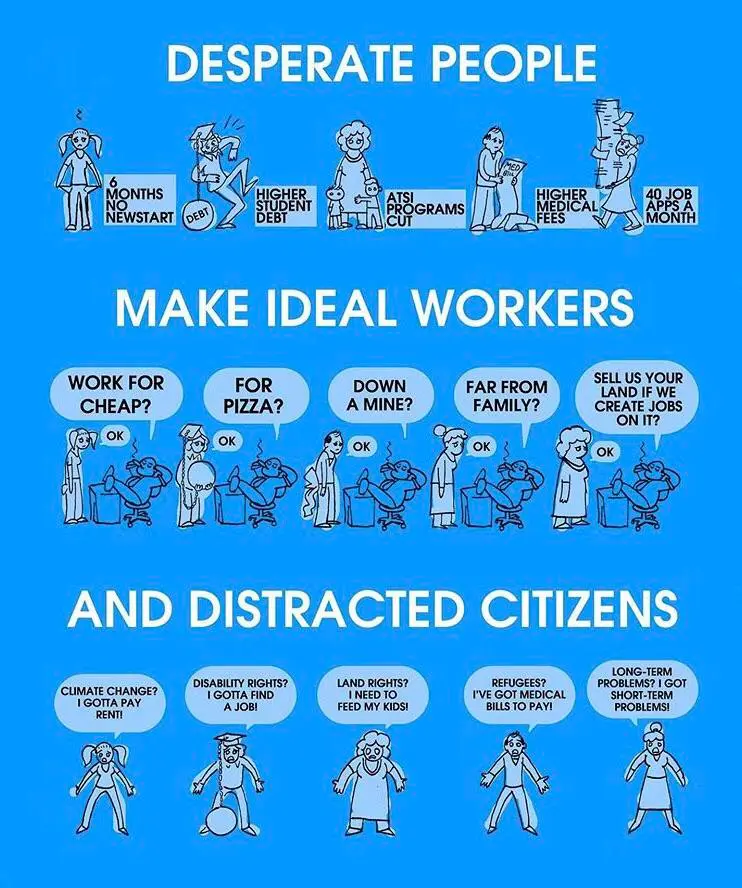
Isn’t the very nature of average sick days used by employees something that if the average is 5 then some people may be 8 and others 2?

I never said that and I never insulted you in the first comment. I used the word hopium which is pretty common word to use these days.
For what it’s worth I apologise if you misinterpreted my initial comment and you feel offended as that wasn’t my intention.
Anyway have a great rest of your day and let’s draw a line under this.
My first comment wasn’t rude, but I’ll concede that my second one was because you incorrectly assumed I was calling out something about your psychology.
As for the information you provided, nothing in there hinted at Google failing as a company and more just highlighting some of the failings of recent times.
Like Reddit dying after the API incident?
Just like Reddit, Google are going nowhere; sadly.
Can’t I just say I forgot my pin? They can’t prove I don’t have a shit memory.

// Todo - Stuff

Blackrock get the voting rights for the shares they hold for funds though and always go with the status quo.
Thanks


Why are you posting this here?